Drones offer a new level of insights for disaster response and their prevention. The potential is huge and slowly but surely acknowledged.
In her webinar on 19 January 2022, Stephanie Lambert, founding employee and Global Sales Operations at the drone company Wingtra, shared her insights about drones making a difference. Watch the recording of the Lunch & Learn session or learn about the most important take aways by reading on.
Take Aways
1
Photogrammetry has existed since the mid 19th century, but only now we can fully leverage it with high quality data from drones. There were even projects where pigeon were used to capture aerial imagery.
2
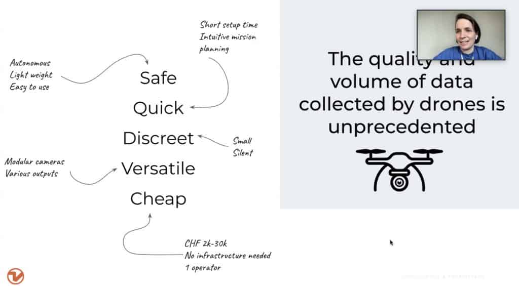
There are 3 main categories of unmanned aerial vehicles (UAV) commonly known as drones: multirotors, fixed wings and VTOL drones.
3
The output drone imagery generates are different map types:
orthomosaics;
point clouds;
elevation models.
4
The applications discussed were all environmental challenges:
I
Climate conditions in East Africa have transformed an insect that’s usually a quiet, solitary grasshopper into an overwhelming invasion of desert locusts. The locusts migrate and devour any crops in their way threatening food security for dozens of communities. The drone data helped to evaluate the damage and analyse effectiveness of sprays.
II
In 2020, California experienced some of the worst wildfires in its history. Massive areas were evacuated, thousands of acres destroyed. The drone data helped for situational awareness for owners, authorities and insurances.
III
On 5 February 2019, a cyclone shoved a bulk carrier into the edge of a reef on Rennell Island, cracking its hull. The fuel oil spill happened along the world’s largest raised coral atoll and just northwest of a UNESCO World Heritage site. The drone data helped divide the beach into segments, classify and prioritise areas according to level of oiling, topographical features and substrate.
IV
A research professor at the University of Alaska and manager of the State of Alaska’s Climate Hazards Program. One of the big projects his research team is working on involves using drone data to visualize and predict a glacier and a glacial lake’s activities. The glacier functions as a dam to the water behind it. In a catastrophic event, all the glacial water drains and would flood a river and surrounding communities. The drone delivered a digital elevation model to estimate thickness of the ice as well as its flux for different seasons.